Property Record
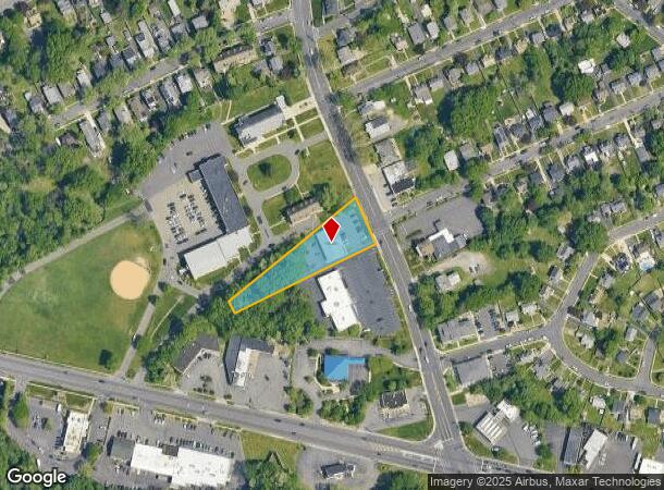
1539 Pennington Rd, Ewing, NJ 08618


NEARBY LISTINGS FOR SALE OR LEASE
Property Detail
1539 Pennington Rd
02-00234-02-00020
ADDITIONAL LOTS: EWING MEDICAL ASSOC
Vacantlandnec
Mercer
AE
New Jersey
34021C0119F
20
2024
0.85 AC
2025
Trenton
003602
Northern New Jersey
4,000 SF
Trenton, NJ
DEMOGRAPHICS near 1539 Pennington Rd
1 Mile
3 Mile
5 Mile
2024 Total Population
17,411
109,904
235,220
2029 Population
17,266
109,095
232,428
Pop Growth 2024-2029
(0.83%)
(0.74%)
(1.19%)
Average Age
41
40
40
2024 Total Households
6,978
41,462
85,844
HH Growth 2024-2029
(1.06%)
(0.82%)
(1.23%)
Median Household Inc
$59,526
$62,917
$74,042
Avg Household Size
2.40
2.50
2.60
2024 Avg HH Vehicles
2.00
1.00
2.00
Median Home Value
$173,298
$223,005
$280,066
Median Year Built
1954
1954
1957
Nearby Places
Map Layers
Map Styles
 Street
 Aerial
- Restaurants
- Banks
- Shops
- Fitness
- Groceries
PUBLIC TRANSPORTATION
COMMUTER RAIL
West Trenton (R3 - Southeastern Pennsylvania Transportation Authority Regional Rail (SEPTA Regional Rail))
DRIVE
WALK
Distance
West Trenton (R3 - Southeastern Pennsylvania Transportation Authority Regional Rail (SEPTA Regional Rail))
6 min
3.1 mi
Trenton Transit Center (Njt) (Northeast Corridor Line - NJ Transit Commuter Rail (NJ Transit), R7 - NJ Transit Commuter Rail (NJ Transit), River LINE - NJ Transit Commuter Rail (NJ Transit))
DRIVE
WALK
Distance
Trenton Transit Center (Njt) (Northeast Corridor Line - NJ Transit Commuter Rail (NJ Transit), R7 - NJ Transit Commuter Rail (NJ Transit), River LINE - NJ Transit Commuter Rail (NJ Transit))
8 min
3.4 mi
AIRPORT
Trenton Mercer
DRIVE
WALK
Distance
Trenton Mercer
9 min
4.0 mi
Freight Ports
Port of Philadelphia
DRIVE
WALK
Distance
Port of Philadelphia
46 min
30.5 mi
Nearby Properties
Address
Land Use
TOTAL SIZE
Lot Size
Zoning
Address
Land Use
TOTAL SIZE
Lot Size
Zoning
67.65 AC
R-1
Address
Land Use
TOTAL SIZE
Lot Size
Zoning
8.23 AC
BA
Address
Land Use
TOTAL SIZE
Lot Size
Zoning
26 AC
HIST
Address
Land Use
TOTAL SIZE
Lot Size
Zoning
141.90 AC
EGI
Address
Land Use
TOTAL SIZE
Lot Size
Zoning
225.40 AC
R-1
Address
Land Use
TOTAL SIZE
Lot Size
Zoning
6.69 AC
BA
Address
Land Use
TOTAL SIZE
Lot Size
Zoning
1,996 SF
125 AC
RA
Address
Land Use
TOTAL SIZE
Lot Size
Zoning
5.97 AC
R-1
Address
Land Use
TOTAL SIZE
Lot Size
Zoning
879,376 SF
2.54 AC
BA
Address
Land Use
TOTAL SIZE
Lot Size
Zoning
4,320 SF
12.06 AC
PRO
Address
Land Use
TOTAL SIZE
Lot Size
Zoning
125,000 SF
3.68 AC
MU
Address
Land Use
TOTAL SIZE
Lot Size
Zoning
96.60 AC
OP-2
Address
Land Use
TOTAL SIZE
Lot Size
Zoning
117.50 AC
OP-1
Address
Land Use
TOTAL SIZE
Lot Size
Zoning
42.80 AC
IP-1
Address
Land Use
TOTAL SIZE
Lot Size
Zoning
104,448 SF
8.49 AC
IA
Address
Land Use
TOTAL SIZE
Lot Size
Zoning
5.38 AC
MU
Address
Land Use
TOTAL SIZE
Lot Size
Zoning
27.21 AC
PRO
Address
Land Use
TOTAL SIZE
Lot Size
Zoning
288,000 SF
1.23 AC
BA
Address
Land Use
TOTAL SIZE
Lot Size
Zoning
6.11 AC
R-1
Address
Land Use
TOTAL SIZE
Lot Size
Zoning
104.60 AC
IP-1
Address
Land Use
TOTAL SIZE
Lot Size
Zoning
35.83 AC
RB
Address
Land Use
TOTAL SIZE
Lot Size
Zoning
56.45 AC
EGI
Address
Land Use
TOTAL SIZE
Lot Size
Zoning
0.24 AC
BA
Address
Land Use
TOTAL SIZE
Lot Size
Zoning
186,960 SF
2.37 AC
BA
Address
Land Use
TOTAL SIZE
Lot Size
Zoning
24.44 AC
AT
Address
Land Use
TOTAL SIZE
Lot Size
Zoning
212,074 SF
0.82 AC
BA
Address
Land Use
TOTAL SIZE
Lot Size
Zoning
23.50 AC
R-2
Address
Land Use
TOTAL SIZE
Lot Size
Zoning
Address
Land Use
TOTAL SIZE
Lot Size
Zoning
323,087 SF
1.95 AC
PM
Address
Land Use
TOTAL SIZE
Lot Size
Zoning
161,080 SF
2.21 AC
BA
The World's #1 Commercial Real Estate Marketplace
Connect with us
© 2025 CoStar Group
The information above has been obtained from sources believed reliable. While we do not doubt its accuracy we have not verified it and make no guarantee, warranty or representation about it. It is your responsibility to independently confirm its accuracy and completeness. Any projections, opinions, assumptions, or estimates used are for example only and do not represent the current or future performance of the property. The value of this transaction to you depends on tax and other factors which should be evaluated by your tax, financial, and legal advisors. You and your advisors should conduct a careful, independent investigation of the property to determine to your satisfaction the suitability of the property for your needs.